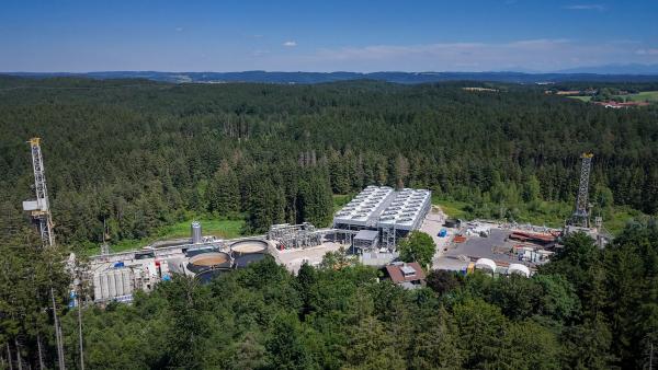
Somewhere west of Pincher Creek, Alta., the vast flatlands of the Canadian Prairies begin to ripple and fold. This is where the last Lethbridge radio station fades to static, where the fields roll up into foothills, where grain elevators, cattle and windmills give way to signposts about ski hills and the remnants of historical coal mines. On the western horizon, the Rockies are sharp-edged, grey spattered with white – the Platonic ideal of mountain. Alberta’s Highway 3 rises steadily toward those perfect peaks, Crowsnest Pass and, on the far side, British Columbia.
From a driver’s perspective, this stretch of two-lane road looks no different than any other – a yellow centre line, twin white ones to mark the shoulders and stretches of rumble strip reminding careless drivers to stay in their lane. Piloting a vehicle at (or, more likely, above) the posted speed limit of 100 kilometres per hour, that driver might not even notice that they are passing over the sort of unheralded highway bridge that spans countless little ravines and creeks and undulations in the land. They might, if they thought about it, assume that an innocuous narrow culvert ran somewhere below them, permitting water to flow under the road; if they were to look left or right at the correct moment, they might notice that the concrete blocks peeking out from under the blacktop on either side of the bridge seemed unusually large.
But the driver represents just one of the species transiting here. Underneath the road, largely invisible to the motorists roaring by up top, another type of transportation infrastructure runs perpendicular to it. The Rock Creek underpass is unsigned and unmarked, at least to most human eyes, but it forms a critical gateway in the other-than-human world. For deer and elk, grizzly and black bears and other, smaller creatures, it offers the possibility of safe passage across the highway without the deadly risks of a dash through traffic.

Completed in December 2025, the structure was built by the Government of Alberta in an effort to reduce the highway’s toll on wildlife in the area – and the toll that wildlife collisions take on people. In the nine years before the Rock Creek underpass opened, nearly 300 animals were struck by vehicles within just the surrounding 10 kilometres, at an estimated average cost to human society – when you assign a monetary value, as actuaries do, to injuries and even deaths, as well as emergency response, lost work time, damaged vehicles and more – of $890,000 per year.
The underpass is a local solution to a longstanding problem, but it’s also one link in a vast, incomplete chain – part of an ambitious scheme to reconnect a massive, fractured landscape. Not that long ago, wolves and deer, bears and cougars and more roamed freely up and down the Rocky Mountains, covering astonishing distances. But by the late 20th century, several major east-west highways on both sides of the Canada-U.S. border had all but severed the animals’ less formal north-south paths. Many conservation groups have attempted to tackle the issue at varying scales, but for the past 30 years, one cross-border organization has focused its mission on, well, the whole big problem. The boldness of the Yellowstone to Yukon Conservation Initiative is right there in its name; it’s a project that spans a distance of 3,400 kilometres, more than 20 degrees of latitude and today includes 200-plus wildlife crossings, like the one at Rock Creek.
Get our weekly newsletter – the people, places, and ideas revealing where Canada is headed.
“To us, roads signify connection and escape; to other lifeforms, they spell death and division,” wrote environmental journalist Ben Goldfarb in his 2023 book, Crossings. According to Goldfarb, while the term “roadkill” appears to date to the 1940s, scientists have been documenting the animals killed by cars for more than a century. “The death-dealing qualities of the motor car are making serious inroads on our native mammals, birds and other forms of animal life,” one biologist fretted all the way back in 1925. Despite his and others’ warnings, in the decades that followed, the problem only grew and grew. Researchers believe that by the end of the 20th century, vehicle strikes exceeded hunting as the number one way in which people killed land-based vertebrate animals.
Early public concerns about roadkill faded as car culture tightened its grip on North America through the middle of the 20th century; soon enough, the animal death toll was simply a built-in price that nature paid for our speed. But that started to change in the 1950s and 1960s as a white-tailed deer population that had been hunted by the millions in the 19th century rebounded and invaded the ever-growing sprawl of suburbia. For a driver, hitting a deer at highway speed is a different proposition than flattening a squirrel or ramming a bird that misjudged its flight path. And collisions were even riskier in those days, before the additions of seat belts, airbags and numerous other modern vehicle safety features. Suddenly, roadkill was killing people, too, and injuring thousands. In the United States, deer-vehicle collisions nearly doubled in just three years, careening from 70,000 in 1963 to 120,000 in 1966. “Cars have made deer North America’s most dangerous wild animal,” Goldfarb writes, “implicated in three times more deaths than wasps and bees, 40 times more than snakes and 400 times more than sharks.”
There will always be some people who worry about the well-being of animals for the animals’ own sake; for others, some self-interest is required to stir them into action. Deer strikes incentivized highway planners and transportation authorities to seek out solutions. European planners started experimenting seriously with dedicated wildlife overpasses in the 1960s and 1970s, but, apart from a few isolated attempts, North America dawdled behind. That changed around the turn of the millennium, when Banff National Park created a series of wildlife crossings along the park’s stretch of the Trans-Canada Highway – formerly known among conservationists as “the Meatmaker.” The impact was immediate. From November 1996 to March 2003, the park recorded 48,682 uses of the structures by nine large mammal species: grizzly and black bears; coyotes, cougars and wolves; and moose, elk, deer and wild mountain sheep. The Banff crossings ultimately reduced highway collisions with deer and elk by more than 96 per cent.
Even before Banff’s big success, the 1990s saw a convergence of new technology and big ideas in conservation. “We were really in a transformational period from a science perspective, where for the first time, we were getting satellite and GPS collars and were able to track animals on a scale that we never had,” says Jodi Hilty, the president and chief scientist of the Yellowstone to Yukon Conservation Initiative, which is based in Canmore, Alta. Improved tracking-collar technology meant researchers were beginning to understand for the first time the sheer scale of many animal migrations; until remarkably recently, scientists hadn’t really understood just how much room many animals need to migrate, feed and breed.

At the same time, a young field of study known as “road ecology” was emerging: the study of how the presence of roads changes life for the plants and animals nearby. And what the early road ecologists found was that the problem was much bigger than just roadkill. When roads got busier and faster, more animals died, but only up to a point. At a certain threshold, the carnage receded because the animals stopped trying to cross the road at all.
With their newfound understanding of migratory dynamics and habitat needs and a clearer sense of just how big an obstacle a road can be, scientists realized that busy highways represented an existential threat to some animal populations. Sometimes that looked like whole herds of ungulates trapped on the wrong side of a highway, cut off from their winter grazing range and starving to death by the dozens; other times it looked like the gene pool for a wide-ranging grizzly bear or a mountain lion shrivelling away.
It was against this backdrop that Y2Y was born. “Scientists and conservationists on both sides of the border got together,” says Hilty, who joined the board in 2011 and became president in 2015. And at that first meeting, in 1993, they considered the sheer scale of conservation required to preserve not just patches of habitat but an entire working ecosystem. “So they came up with this idea of a 3,400-kilometre-long mountainous region. And that’s the audacious part – how do you get that done?”
For Y2Y, the non-profit organization that grew out of that first meeting, the answer is a multi-pronged approach: shoring up and expanding the isolated pockets of protected land that had been the focus of conservationists up until the 1990s, but also thinking big-picture about animal movement throughout the region and how it can be facilitated and restored. In the 30-plus years since its founding, Y2Y has seen more than 200 wildlife crossings installed across its region. But it has also achieved something that’s harder to quantify: it has helped popularize and normalize the concept of landscape connectivity. “People know about it now,” says Emilie Brien, the region’s natural area manager for the Nature Conservancy of Canada, a partner on the Rock Creek project. “Even 10 years ago, when you talked about connectivity, people didn’t know what you were talking about at all…. Y2Y has been excellent in sharing that.”
Y2Y’s approach is collaborative as a matter of both practice and principle: over its three decades, it has partnered with more than 800 different groups, including federal, Indigenous, state, provincial and local governments, research institutions, land trusts and other conservation non-profits. It supports research, it helps drive funding to existing local efforts and it operates as a sort of umbrella organization with the overarching goal of reconnecting the landscape across the entire region. So while a local group might be primarily interested in reducing local collisions, Y2Y will back its efforts with an eye to the big picture. Hilty sees Y2Y as the keeper of that original audacious 3,400-kilometre vision. It’s the vision that defines the scope of their work, which could otherwise sprawl. “We talk about being super disciplined about building on our strengths,” she says. “We can’t do everything or we’ll get nothing done.”

Nearly 16 metres wide, four and a half metres tall and just shy of 14 metres long, the Rock Creek underpass offers clear sightlines from one side to the other. Above, the highway bridges one natural rise in the landscape with another, and the underpass is essentially a saddle between them – but one with an unnatural concrete roof. The ground around the crossing is still bare earth (grasses and shrubs will grow in over time), and the sharp little impressions left by deer hooves are clearly visible in its soft surface. A scattering of young trees has been planted to help the animals that use the underpass feel more at ease.
The passage had been in the works for more than 15 years. Its approximate site was first identified in a research paper in 2010: the area, in the transition zone between prairie and mountains, was an important corridor for wildlife movement, and researchers already knew that it was a high-collision area. Its importance was re-emphasized in a subsequent paper published in 2019, and later that same year, the Alberta government committed $10.7 million to the project.
Even once a crossing for a given area is approved and funded, selecting a precise location requires significant legwork. “A big part of these projects is trying to figure out where they should go,” says Tim Johnson, a landscape-connectivity specialist at Y2Y who worked on the Rock Creek project. That means not only crunching the roadkill data from highway crews but also placing cameras along the highway to see where animals are turning back rather than attempting to cross, and even hiking tracts of land perpendicular to the highway to get a more complete roadkill count, since many animals crawl away from the asphalt before dying.

It helps if a location’s topography is conducive to building. In Rock Creek’s case, the existing bridge-and-culvert set-up, connecting two natural rises in the land, made a large underpass more feasible – which is also to say, more affordable. Proponents also need to consider the surrounding land and who owns it.
Wildlife crossings need to be accompanied by extensive fencing, designed to funnel animals toward the underpass or overpass, in order to be most effective. (Along both sides of the highway, Rock Creek’s crossing is surrounded by 10 kilometres of fencing that’s too high for deer or elk to jump and specially designed to prevent bears in particular from simply climbing over it.) That often means negotiations with landowners about easements and permissions. A crossing also won’t be effective if the land on either side of it is developed after it’s built – the goal isn’t to funnel deer and bears into a newly built subdivision. While most of the physical highway crossings themselves are government-funded, Y2Y and other advocates often partner with land trusts – in Rock Creek’s case, the Southern Alberta Land Trust Society, a rancher-led initiative – to permanently secure the parcels needed on either end of a given structure.
Then there’s the question of the infrastructure itself: its size, shape and other attributes. Different animals tend to prefer different styles of crossing, so designers need to know who their users will be. “For the most part [here], it’s the ungulates – the deer, the elk,” says Johnson. “Occasionally we’ll see moose in this part of the Crowsnest Pass area. And then black bears and grizzlies, probably throw in a handful of cougars and coyotes, maybe a wolf or two every couple years…” So ideally, any crossing would be usable by the whole spectrum of large mammals in the area, whether herbivore, omnivore or carnivore.
There are even differences within species to consider. A male grizzly will saunter through an underpass with all the confidence of an apex predator, but a female with cubs will prefer an overpass – from up there, she can see a predatory male grizzly coming. That said, Johnson notes, the females will use an underpass if it’s wide enough – hence the airy dimensions of Rock Creek’s crossing, intended to make it effective for as many animal users as possible.


Design work began on the Rock Creek underpass in 2020, according to Stephen Legaree, the director of environmental regulation at Alberta’s Department of Transportation and Economic Corridors. Ground was broken in the spring of 2024, and the project was ultimately completed by the province in late 2025. (The final cost came in at $11 million.) It’s the first dedicated wildlife crossing in the Crowsnest Pass region of Highway 3, but it won’t be the last: Alberta and British Columbia are collaborating to eventually create 39 wildlife crossings of some kind along the highway, including five dedicated structures in Alberta and two in B.C.
The science of wildlife crossings is iterative: the successes and failures of each one that we build contribute to the design of the next. Part of Emilie Brien’s job, now that the crossing is complete, is to manage a network of more than 100 cameras along Highway 3 near Rock Creek – “so we can see what’s crossing, what’s not crossing,” she says. She and the other partners on the science side of the Rock Creek project are still analyzing all the photos from the crossing’s first six months to come up with firm usage numbers. But they do know that the animals already making use of it include cougars, coyotes, foxes, elk, moose and both mule deer and white-tailed deer.
Each crossing also builds on the last in the public imagination, as awareness spreads of how effective they can be. Wildlife crossings themselves are broadly popular across the political spectrum, but the network of protected lands they’re meant to connect can be more contentious. According to Brien, at the Nature Conservancy of Canada, it’s about “trying to strike a balance between conservation and people and development.
“I live in the Crowsnest Pass, so I know that we need places [where] we can build more houses, we need industries to have jobs,” she says. “Highway 3, it’s a problem for wildlife, but I drive it all the time…. I think the big challenge is to balance wildlife and people. You can find a happy medium, but it’s always a bit of push and pull.”
The Rock Creek crossing isn’t a panacea; its presence has not magically rewilded that foothilly stretch of Highway 3 between Lundbreck and Bellevue. An animal working its way along the fence toward the underpass still has a lot to contend with: it will pass by ranch homes with homemade “No Trespassing” signs spray-painted in white on old tires and chained dogs barking from behind barbed-wire fences. Sometimes, it will hear the perpetual dull roar of the highway being eclipsed by a freight train hooting and clacking and whining its way by on the tracks that parallel the road. It will see the traffic on the road get heavier as time goes by and more buildings go up alongside the pavement.
But the odds are a lot better now that it won’t wind up as a statistic smeared on the shoulder. With public support and commitments from local governments, there is reason to hope that we can keep improving the rate of safe passage across the landscape – for humans and animals alike.
“I drove highways that ended lives,” Goldfarb wrote in Crossings. “I lost track of how many elk littered the shoulder on Crowsnest Pass.” That sentence was published just three years ago. But on a blustery spring day in May, on that innocuous stretch of highway where the prairie climbs up to meet the Rockies, there was not a single roadside carcass to be seen.