Get our weekly newsletter – the people, places, and ideas revealing where Canada is headed.
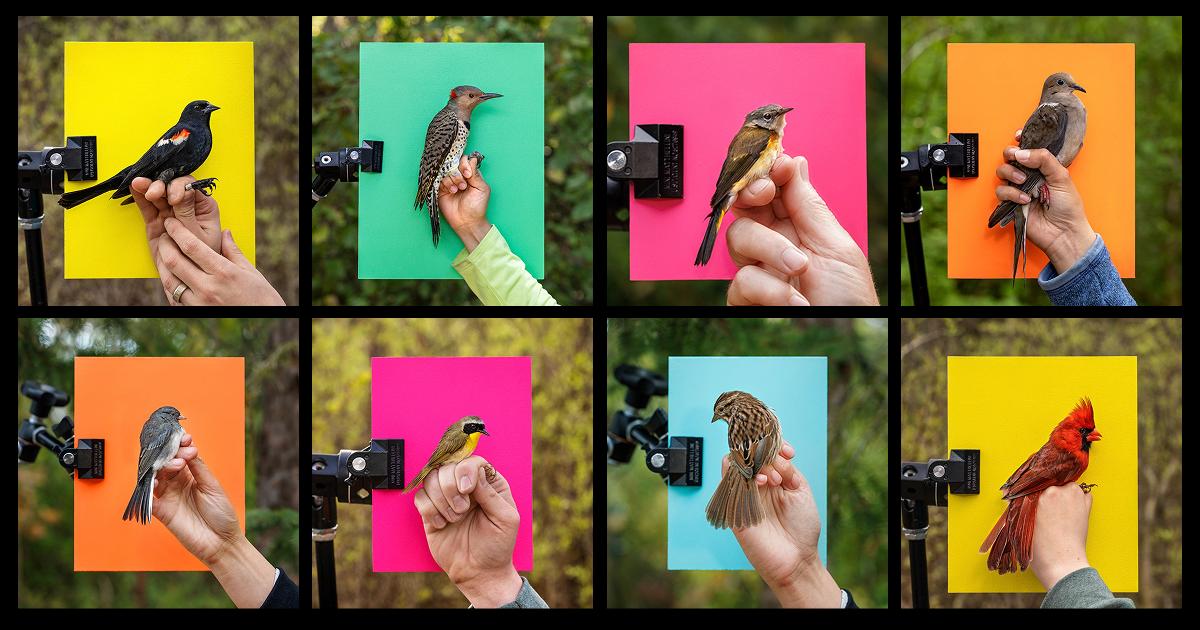
It’s migration season and a tiny hermit thrush, the weight of a slice of bread, is being tagged at Lake Erie’s Long Point Bird Observatory’s Old Cut Research Station. First, an ID band is clipped around the bird’s leg, then an ultra-light, wafer-thin radio-transmitter tag with a short, flexible antenna is attached to its back. The thrush looks slightly annoyed but otherwise calm, unaware that it has just become the newest participant in a global pursuit to unlock mysteries of avian movement and halt a precipitous decline in bird populations.
The number of birds in North America, including familiar species of sparrows, warblers, blackbirds and swallows, has fallen by 2.9 billion since 1970, according to a 2019 study conducted by a consortium of researchers, including the Cornell Lab of Ornithology and Environment and Climate Change Canada. The near 30 per cent decline is linked to a combination of factors, including land conversion and climate change. One group trying to change that is Motus, a Canada-based research network whose wildlife-tracking system is now being sported by one more hermit thrush as part of an international effort to provide scientists with reams of new data on avian behaviour.
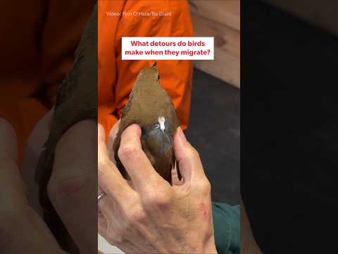
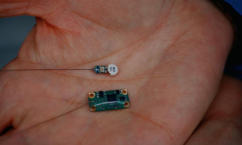
Each of its tags emits a unique signal two to 10 times a minute, which is detected by antenna-receiver systems on any Motus tower within a 10- to 15-kilometre range. “[The readout] allows us to tell not only when they’re here but how long they’re here, when they decide to leave, and how long it takes them to fly from point A to point B,” explains Stu Mackenzie, director of strategic assets at Birds Canada, the bird-conservation charity that runs both the Long Point Bird Observatory and Motus itself.
Motus, which means “movement” in Latin, has been Mackenzie’s baby since it launched in 2014 after several years of development and testing, primarily at Long Point, a critical stopover site for hundreds of migratory bird species which has been designated as a UNESCO biosphere reserve. The original idea of putting hand-held radio receivers on towers to create a network array came from Phil Taylor, a now-retired professor of ornithology at Acadia University with whom Mackenzie worked when he was still a grad student. Since then, what began as a cluster of five receiving stations has significantly improved scientific understanding of bird movement and migration. Today, the network numbers around 2,400 stations in 34 countries with an open-source database that holds tracking information on nearly 65,000 tagged wildlife specimens – primarily birds, along with some bats and insects.
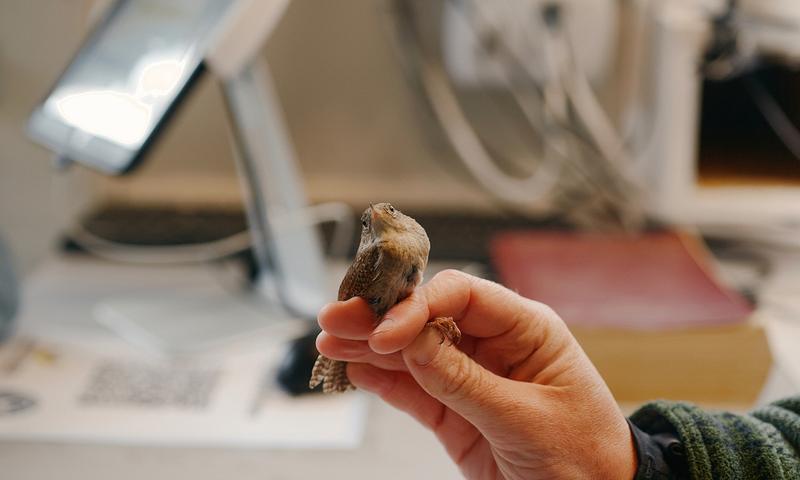
One early study used Motus data to reveal routes that thrushes tagged in Colombia follow to return to their summering grounds in Ontario and Saskatchewan. One bird made the 6,000-kilometre journey in just 34 days, and scientists were able to follow the details of the entire trip. “It was a wow moment,” Mackenzie says.
In another study, researchers used Motus to track a red knot (a shorebird that breeds in the Arctic and winters in southern Argentina) leaving James Bay and arriving in Delaware the next morning, flying at an incredible average speed of 120 kilometres per hour. “We’re discovering new migration routes all the time, or things that were thought to occur but we had no way of proving until we had Motus,” says Mackenzie.
Shedding light on the behaviour of migratory birds summering in Canada, who are breeding and rearing young and then returning south for the winter, is vital. Each year, they number in the billions – 80 per cent of all bird species that spend summers here leave the country in the fall – yet many are in serious decline. “Most mortality happens during migration,” says Mackenzie. “What [birds] rely on in that time is good stopover sites and adequate habitat throughout their entire journey. Motus is one tool to allow us to measure or identify pinch points where mortality might happen. It also allows us to prioritize habitat protection.”
Birds Canada runs Motus in partnership with Western University, the University of Saskatchewan, the University of Guelph, the University of Waterloo and Acadia University. Western, based in London, Ont. has played an especially large, collaborative role; the day Be Giant visited, a contingent from the school was on hand to sign an agreement formalizing existing relationships in research, student training and technological innovation. One of those present was Chris Guglielmo, a Western biology professor and current director of the school’s Centre for Animals on the Move, who has been a research partner from Motus’s beginning. He recalls a pivotal moment when Taylor figured out how to build receivers using cheap mass-market materials and make the design open source. At the time, the Motus team had just won a grant to purchase and deploy 40 commercial receivers. But by using the low-budget hardware, they were able to deploy 160 stations instead.
“That’s how Motus became a real thing, because we put out 80 in southern Ontario and we put another 80 in Nova Scotia and New Brunswick,” Guglielmo says. “We showed that, wow, you could get all this movement data from these little birds wearing these little nanotags.”
Motus’s cost and utility advantages extend to the tags themselves. At roughly $300 a pop, they are many times cheaper than those used in satellite-based tracking systems. And unlike geolocator tags, which track bird locations by measuring the angle of the sun but require researchers to recapture the creature to collect the data, Motus tags allow anyone to follow a bird’s movements online. The system automatically knows which bird is which because every individual tag has a signature signal based on its pattern and frequency. The Motus website also gives users the option to view all traffic recorded at any individual station.
“Motus gave people something to grab on to, where everybody – a small nature club or a university or research lab, all the way up to large conservation organizations and provincial and state governments – can contribute. It was that curiosity and that collaboration that made it really take off,” says Mackenzie.


Major users of Motus south of the border include the U.S. Fish and Wildlife Service, which has deployed Motus towers for bird-migration studies and conservation planning in every region of the country, as well as the National Audubon Society, one of the oldest and largest non-profit bird-conservation organizations in the world, and the Nature Conservancy, a globally active conservation organization. Projects in Colombia also helped spark interest elsewhere in Latin America, such as Costa Rica, Belize and around the Gulf of Mexico, says Mackenzie. “Before we knew it, we’d created this hemispheric network.” Yet while expansion ramps up abroad, there are areas in Canada where the density of Motus towers is still lacking. For example, he says, they are currently working on filling out the network across Saskatchewan.
Other innovations are aimed at expanding the reach farther still. Motus has recently begun using tags that emit Bluetooth signals, which can be captured not only by Motus towers but also by cellphones. These tags are best suited for butterflies, dragonflies and other insects, Mackenzie says, "things that are flying low … and that are migrating during the daytime.”
Researchers are also making new discoveries, such as the impact of wildfire smoke on bird movement, by digging through the existing archived data. “Storm patterns, severe weather, these things we think are going to happen with climate change,” says Guglielmo. “Having lots of birds tagged and moving around for other purposes creates data that people can go back and look at later.”
He stresses that they’re still expanding stations’ functionality. “Something that’s come on really strong in the last several years is acoustic monitoring – basically putting microphones up and listening to bird calls at night,” Guglielmo says. Motus then uploads the files to the cloud, where a machine-learning model identifies the number and types of species calling – capturing data even from birds that are not tagged.
“It’s [now] a robust research infrastructure network,” says Mackenzie. “[Motus has] been focused on tracking, but … once you have a tower, it’s easy to put other stuff on it.”
From there, it’s up to policymakers, NGOs and conservation groups to turn the information into action to save more birds. “You can’t conserve what you don’t understand,” says Mackenzie. “Most of what we’re doing is trying to understand.”