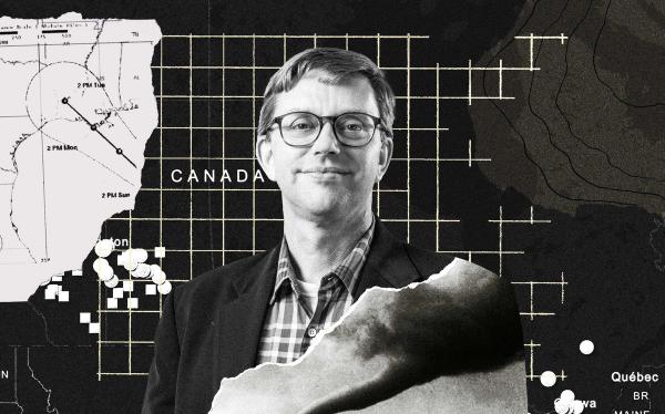
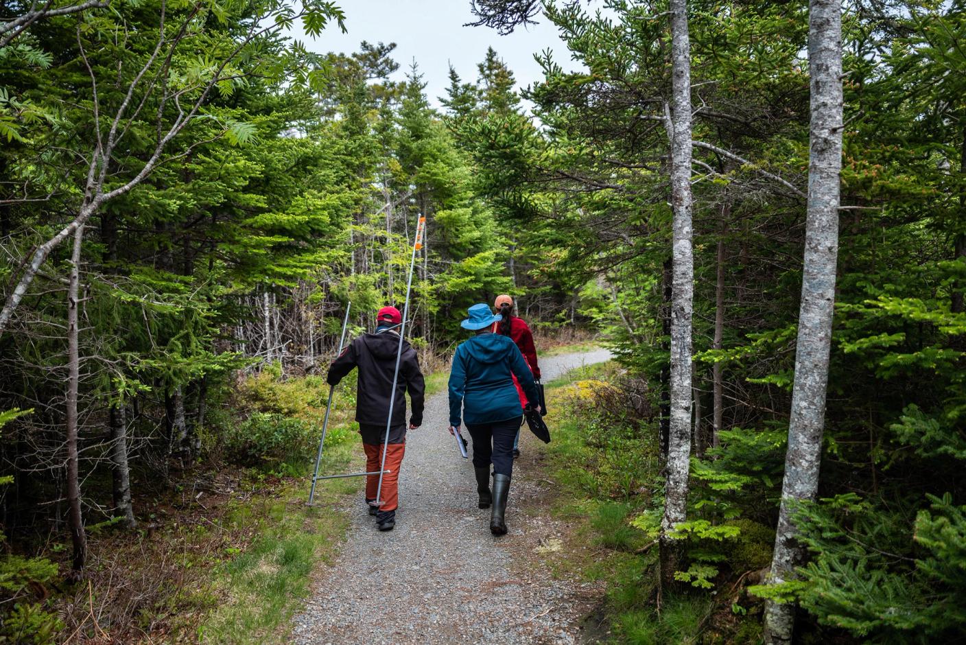
Camilo Botero grins and hands me a measuring device. It stands about six feet tall and is made from four dollar-store curtain rods – two vertical legs and two bars running horizontally – affixed in the shape of a flimsy square, kind of like the frame of a fence.
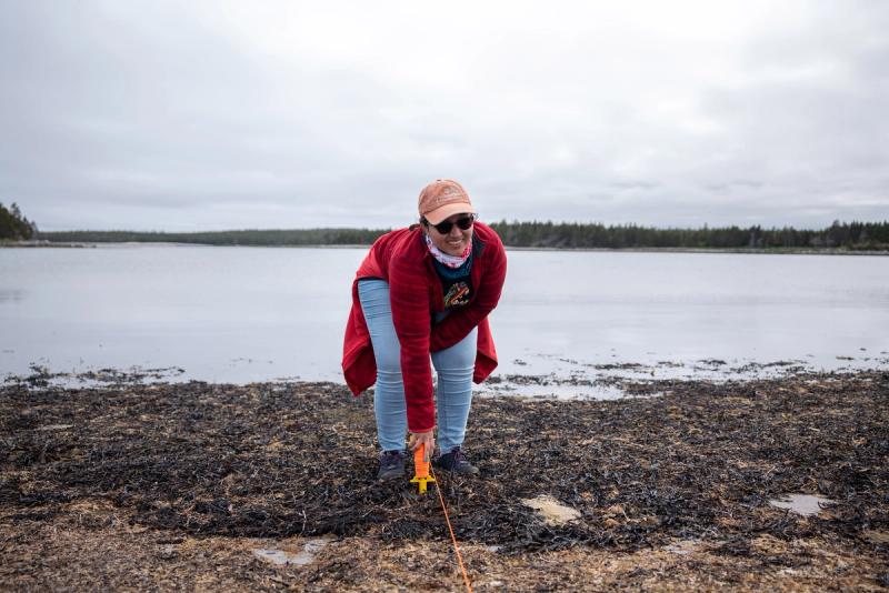
It’s my turn to measure the slope of the beach. It works like this: you place the back leg on the sand, then you place the front leg on the sand. You measure the discrepancy between the two with a third bar that runs level to the ground and a cheap tailor's measuring tape, and you've got your slope.
This low-cost beach-profiling device, which Botero, a Colombian-born coastal geographer and visiting scholar at Halifax’s Dalhousie University, discovered in a paper by University of Delaware researchers, wobbles a bit, but it gets the job done.
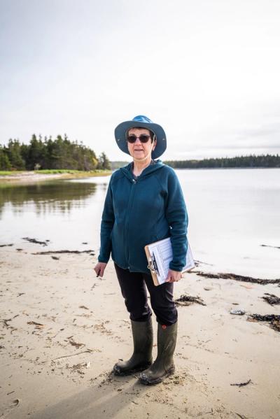
The data collected with this simple tool is of immeasurable value to fighting beach erosion and the effects of climate change at Black Duck Cove, part of a small provincial park near Little Dover on Nova Scotia’s remote Eastern Shore. We’ll measure the beach slope again every metre, from the top of the beach down to the Atlantic Ocean, or until the water gets to our feet, which could be soon. We’ve missed low tide by about an hour.
It’s the day of the Strawberry Moon, June’s full moon. I’ve joined Botero, his wife, Cristina Pereira, also a Colombian-born coastal scientist, and Colleen Boudreau, Little Dover’s postmaster, on their monthly meet-up at the cove.
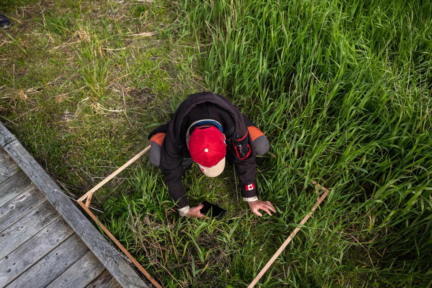
Boudreau and I move down the beach and start working our way from the boardwalk to the water’s edge. Pereira collects grains of sand at different points along the section of beach we measured down to the water's edge. Afterward, Pereira and Botero will follow our line with another square, this one wooden, using it as a frame to measure beach vegetation square metre by square metre. They will identify plant species and their abundance within each square.
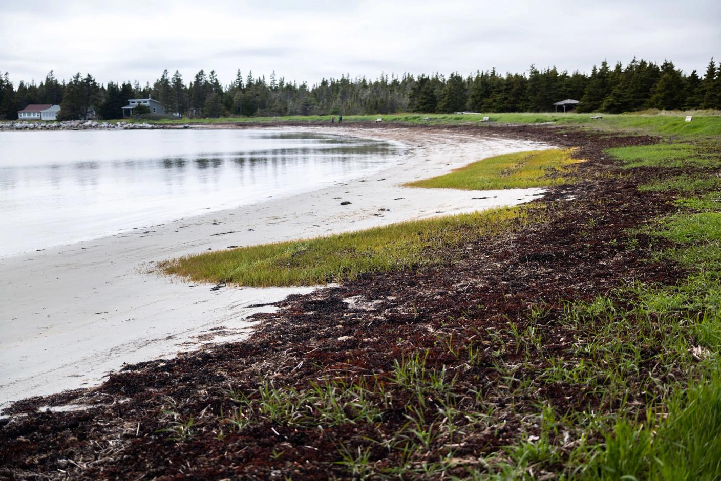
“A beach is not supposed to have so much green,” says Pereira, pointing to the thick grass growing across the sand. Pereira, who works as a park attendant at Black Duck Cove, noticed that the first time she and Botero came to the beach.
The couple moved to Halifax in 2022. At the invitation of Dalhousie University's Faculty of Management, Botero spent the next summer driving 7,000 kilometres classifying the province’s 149 beaches based on their beauty and assessing the usefulness of the Coastal Scenery Evaluation System, designed by European researchers in 2004. Botero saw the CSES as a coastal management tool, and says that he and Pereira fell in love with the still wild and undeveloped coastline. The pair had been planning to immigrate to Nova Scotia since 2019, and when they saw a listing for a little grey house in an idyllic seaside town, they put in an offer.
Boudreau was born and raised in Little Dover. She says the flat sand where we’re measuring the grasses used to be three big dunes. She recalls how when she was a kid, everyone would rush to the beach and try to reach a dune first.
But the coastline has changed, and that’s why we’re here. I’ve joined Botero, Boudreau and Pereira of the Eastern Shore Coastal Monitoring Network (ESCOM) for the day. It’s a citizen science initiative Botero started that collects hyperlocal data on beach erosion, sea-level changes, weather patterns and marine biodiversity.
ESCOM has around 50 active volunteer members, the vast majority over 65, spread across 12 communities along the rugged Eastern Shore Coast, from the nearby Strait of Canso to the Eastern Passage in Dartmouth. In addition to beach monitoring, ESCOM members have set up weather stations to track daily temperatures and precipitation.
The reality of how climate change is affecting this beautiful part of the world is only too clear to the locals. Botero’s army of volunteer citizen scientists is fighting an uphill battle to control coastal changes. It’s a battle they will not win without hyperlocal data and historical records, hence their determination and volunteer hours with wobbly but effective MacGyvered gear.
Little Dover could be an artist’s rendition of a perfect Nova Scotia town – a road hugs a shoreline tidily stacked with lobster traps; fishing boats bob next to a battered wharf. The parking lot at the marina is filled with pickup trucks awaiting their drivers’ return with the day’s catch. And everyone you pass on the road gives a friendly wave.
There’s a cost for rugged and remote. The Eastern Shore of Nova Scotia is highly susceptible to the effects of climate change. Sea levels in the region are predicted to rise one metre by the end of the century, a risk exacerbated by Nova Scotia’s slowly sinking landmass. Warming oceans intensify post-tropical storms and hurricanes, leading to extreme storm surges that accelerate the retreat of already fragile shorelines.
Hurricane Fiona, one of the most destructive and costly storms in Canadian history, made landfall at Little Dover’s doorstep in September 2022, costing the province more than $385 million in insured damage. The true cost, including uninsured losses, would be much higher. These storms will continue to come. As sea levels rise, they’ll reach farther inland. The climate change mitigation plan for the greater region identifies Little Dover’s critical infrastructure, including its wastewater treatment plant, as vulnerable to coastal flooding.
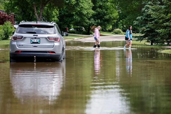
And it’s not just intense storm surges and flooding. Climate change also contributes to prolonged drought conditions in the province. Last summer, communities across Nova Scotia, including Little Dover, experienced extreme drought. Botero estimates about 60 per cent of the community was without water for two months. Residents were given 28 litres a week, distributed through tickets they exchanged at the local co-op grocery store. The provincial government spent more than $700,000 on bottled water.
“It would maybe be cheaper to be prepared,” he says. “We have great methodologies that can say, ‘There will be a drought.‘” But to do that, you need historical records and hyperlocal data. ESCOM is actively building that dataset, says Botero.
I ask Botero why it falls on the community to collect its own data. He says it’s too costly for governments to measure coastal erosion. “They only like to use very fancy high-tech [gear] that is too expensive,” he says. Beach-profiling equipment can cost thousands of dollars and take months of training to use. Botero says ESCOM’s tool costs $40 and takes 30 minutes to learn how to operate.
But tracking climate change-fuelled erosion is also logistically challenging: the government doesn’t have the resources or the staff to measure 150 beaches every month, says Botero. And it doesn’t want to.
In 2024, the Nova Scotia government shelved the Coastal Protection Act, passed five years earlier and hailed as the first legislation of its kind in Canada. The purpose of the act was to ban problematic coastal development and set rules to protect property owners and sensitive ecosystems from sea-level rise, storm surges and coastal erosion. Instead, the province pivoted to a new plan, The Future of Nova Scotia's Coastline, which relies on municipal leadership and individual property owners to make “informed decisions” about how to handle complex coastal erosion and sea-level rise.
In Colombia, Botero spent eight years studying coastal legislation and challenging politicians in congress. He knows all too well that data – proof, really – is key to informed decision-making. As I drive around Little Dover, I notice “We say no to the Canso Spaceport” signs nailed to posts and mailboxes. Since 2022, Halifax-based Maritime Launch Services has been building Spaceport Nova Scotia, a commercial launch facility for satellites, at the edge of the nearby town of Canso. Some locals are unimpressed, but the federal government is all in. In March 2026, the government announced it would invest $200 million over 10 years to lease a dedicated launchpad.
Botero takes me to see the site where, just a week earlier, he watched the first rockets on a test flight take off. He’s neutral when he talks about it, maybe hedging. But he points out that deciding where and where not to put a spaceport is exactly the kind of decision that could benefit from ESCOM’s data.
That’s part of what motivates the ESCOM citizen scientists. The data they collect will be uploaded into a platform Botero helped build alongside computer engineers and machine-learning researchers at Dalhousie. The goal is to teach these citizen scientists to analyze the data so they can make better-informed decisions around climate resilience in their communities, Botero explains. He says it is important to empower the people with their own data.
I’m curious about the scalability of Botero’s network, so he introduces me to Marian Lucas-Jefferies, a retired priest with the Anglican Church and one of his key partners at ESCOM. The pair met four years ago over Zoom at a speed-dating-style event where environmentalists sat down to talk about what they were working on. Lucas-Jefferies is the co-ordinator for the Diocesan Environment Network (DEN) of Nova Scotia and Prince Edward Island. “There were five people that I met that night, but Botero was the one who was perseverant … kind of like that mosquito that won’t go away,” she says.
Botero had yet to start ESCOM, but he told Lucas-Jefferies what he was planning. She asked how DEN could help. “He grabbed that right away,” she says. “Next thing I know, I'm meeting him at the library in Dartmouth.”
Lucas-Jefferies says Botero floated the idea of connecting the church with the community – “As they say, you can’t spit in Nova Scotia without hitting an Anglican church,” she says – and building a force to be reckoned with that would produce these citizen scientists. Lucas-Jefferies, who’d spent time as a community development worker, thought the idea was brilliant. The two began building the network, securing funding from the Anglican Church for weather stations and connecting with Eastern Shore parishes.
She says the partnership between the church and the community is just a snapshot of the scalability of a project like this; all it takes is a few people who are passionate about the environment and concerned about how the place they call home is changing.
“As a priest, I’m to deliver a message of hope, and in order to really deal with the eco-grief that so many people face these days, I need to empower people,” she says. “If we give them the tools … if they learn how to measure the tide and the weather, then they get confidence, and they want more knowledge.”
Of course, that requires engagement, something Botero still struggles with in his pocket of the Eastern Shore. Earlier, while driving to survey Black Duck Cove, Botero and I passed a local walking alongside the highway and collecting trash. She was planning to join ESCOM’s beach measurement, but we were running behind, and Botero was puzzled that she wasn’t already on her way to the cove. (In the end, she didn’t show up, perhaps having exhausted her volunteer activities for the day.) While exploring the coast, we pulled into the driveway of a new recruit who was supposed to be home but wasn’t, another would-be citizen scientist not making it out this time.
It’s a problem Botero is trying to solve with his infectious persistence. ESCOM has enlisted about 18 students and researchers from Dalhousie to improve its process, says Gabriel Spadon, an assistant professor at the university’s Faculty of Computer Science whose work focuses on data analytics and spatiotemporal analysis, uncovering dynamic patterns such as environmental changes. The university’s work with ESCOM is funded by the Ocean Frontier Institute, an Atlantic Canada-based non-profit.
With the funding, Spadon and Oladapo Oyebode, also an assistant professor at Dalhousie and co-director of the university’s Persuasive Computing Lab, are leading a team of researchers trying to figure out how to use artificial intelligence and machine learning to turn the raw data into something more usable.
Spadon says they’re also building an AI chatbot that ESCOM’s citizen scientists could interact with to go deeper into the numbers and ask questions such as whether the data shows coastal erosion. “These people are the ones who feel the changes, but sometimes they do not know how to quantify these changes,” says Spadon.
Oyebode says they’ve also developed a gamification engine that will allow citizen scientists to earn points and badges for data collection, adding a small dose of competition. Outside of the technical bits, the gamification part has Botero written all over it. At breakfast, he told me about a course he took on gamification in the classroom and how he was in the middle of designing a board game when the pandemic hit.
“I really liked games,” he says. “There are some people that are really freaky with this stuff … with the gamification, we will keep them engaged. Because we’ll say, ‘Once you finish with this weather station, we’ll give you a badge. And if you continue, [we] will give you another badge.’”
The tide comes back in, and the sun lowers. Pereira, Botero and I meet Billy, a local fisher out for an evening stroll, on the Black Duck Cove boardwalk. At 77, Billy tells us he spent 60 years fishing these waters. He says that when he was a kid, the bottom of the cove was thick with green sea urchins, known locally as sea eggs. The urchins would go for the bait in the lobster traps. “You’d have to pick the pot up, roll it over and shake it until the sea eggs fell out,” he says.
In the 1980s, Billy says a big storm scattered the lobster traps in the woods. A rock as big as a gazebo, big enough for him to hide behind to hunt ducks, was picked up by that storm. “Where did the rock go? We never, ever found it,” says Billy.
Gone, too, were the sea eggs; they never came back to the cove after that storm.
In a way, Billy’s observation offers an alternative perspective on the puzzling grass spreading on the shore: perhaps storms have wiped away natural barriers and pushed debris farther into the cove and up into the beach, fertilizing vegetation that would otherwise struggle to find nutrients. Cause and effect, but now there’s data.
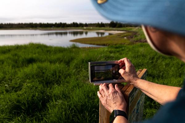
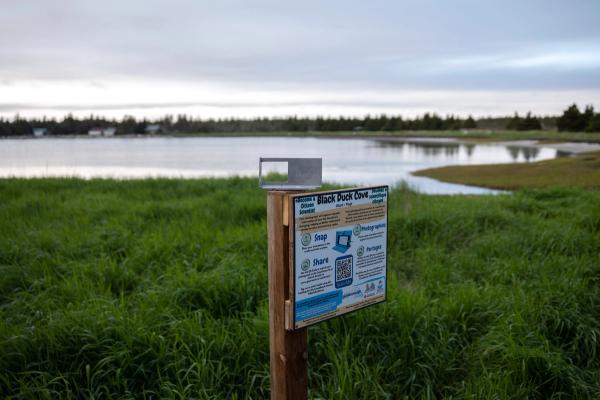
When Billy mentions he walks the cove daily, Botero, who's holding all the beach-measuring gear, tells the fisher he should snap a daily photo of the beach. “I don’t own a camera, I don’t own a cellphone, I don’t have no computer,” says Billy, grinning. Pereira and I laugh, but Botero, ever persistent, sees an opportunity.
He thinks of Billy’s grandson, Dakota, and tells Billy, “This could be a good chance to say to him: 'Come with me, you will be in charge of the photo,' but also you will have some time to spend with him.”
Billy chuckles, but does seem to consider the idea before continuing his walk. It occurs to me that these are the interactions that matter to Botero; his persistence is his magnetism. I ask Botero how many people he thinks he needs for critical mass in Little Dover.
“If we reach 10 per cent of the population, this is good enough,” he says. In such a tiny village, that might not be as challenging as it sounds. “Once we have 15 committed citizen scientists, any conversation about the environment and the coast will change to a scientific perspective because someone can offer the data. We’re going to change the decision-making.”
Get our weekly newsletter – the people, places, and ideas revealing where Canada is headed.